Don't be put off by the main "trail" (but don't forget your boots!)...
or by the "clearcut" effect you first see (southeast corner). This photo was taken before new trees were planted last fall.
Salmon River runs through it
 |
| Great Blue Heron |
 |
| Great Blue Heron snags the raptors' snag |
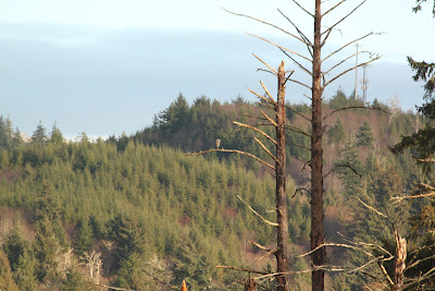
On the east side of the river, raptor snags tower over the marsh (seen from the main trail)
Looking north across the river...
Looking back up the river (east) from the end of the main trail (northwest corner of Pixieland).
Convergence of Fraser Creek with Salmon River at high tide at end of main trail (view from Highway 101).
Fraser Creek at low tide.
The tidal effect is back, thanks to the planned removal of tree-covered dikes. Several bird houses were added to offset the removal of trees. This tree is one of my favorites - glad it wasn't on a dike!
Sparrow corner (south side, at the west end of the road).
 |
| White and Golden-Crowned Sparrows |
New plantings (southwest corner)...
but you have to cross this clever bridge to get there!
Throughout, the grassy marsh is interspersed with a variety of trees, old and new...
 |
| Northern Harrier |
where NORTHERN HARRIERS and other raptors stalk their prey.
Dry in the summer and early fall...
and teeming with wildlife in the wet fall and winter months.
 |
| Great Blue Heron |
Need to know how to find Pixieland? I created a map here that shows where Pixieland is and where the "trails" are. CAUTION: You need wellies even if you stay on the main trails (repurposed dirt roads).


No comments:
Post a Comment