Notes, birds, nature, meanderings.

Musings about birds, nature, and our meanderings on the Central Oregon Coast

Sunday, May 29, 2011

Siltcoos Recreation Area Lagoon Trail

Last weekend we drove south, heading for Coos Bay, stopping at various spots we'd chosen from the Oregon Coast Birding Trail guide.  We only made it as far as Florence, spending most of our time in Honeyman State Park and the Siltcoos Recreation Area.  We've rambled around Honeyman before, but this was our first venture into the Siltcoos River area, and we enjoyed finding the trails identified in the guide. 

Looking for the Lagoon trailhead, we were confused by the signs and finally parked in an area marked "Stagecoach Trailhead" to try to figure out where the Lagoon Trail was.  It turns out that the Stagecoach is the trailhead for three trails, including both Waxmyrtle and Lagoon.  We later discovered another trailhead in the Lagoon campgrounds.


The trail loops around an oxbow of the Siltcoos River, where lush vegetation provides habitat for a variety of birds and reptiles.


The trail starts with a boardwalk across the water, with a viewing area.   


We searched in vain for American Bittern and Green Herons, who must surely love the tall marshy grass.  We heard what sounded a bit like a dog barking, until a GREAT BLUE HERON flew out from the grass and we recognized the rough call.


Walking past the boardwalk into the woods, we could see the adjacent, nearly empty campground.  Probably a busy place in warmer weather. 


Rufous Hummingbird


Several RUFOUS HUMMINGBIRDS zipped between the trees between the campground and the trail.  One brightly colored male paused for a moment in a large fir tree.

Wrentit


We were greeted noisily by an irate WRENTIT, who stuck close by our heads for quite awhile, perhaps until we were well out of range of his chosen nesting place? 
Wrentit
Red Legged Frog


Signs along the trail provided information about the changing habitat and its residents, one of them being the RED LEGGED FROG.  Sharp eyes spotted one in the leaves by the trail.


The river vegetation changed as we neared the peak of the oxbow.  We could hear the songbirds in the shrubs across the water, but spotted very few.  An OSPREY flying overhead may have encouraged them to stay well hidden.


As we headed back to our car, movement in the top of a large tree caught our eye, where a pair of RED CROSSBILLS were perched.  The female stayed hidden, but the male peered out from the very top.
Red Crossbill
The Lagoon Trail is a wide, easy walk - about a half-mile long - perfect for a hand-in-hand stroll.  We plan to return in the fall for the migratory birds, and again in the winter for the waterfowl who make the lagoon their winter home. 

The Siltcoos Recreation Area is a fee area, with both day-use and camping.  The recreational vehicle areas are well removed from the wildlife refuge areas, allowing both to co-exist in relative harmony.  For the three trails, plan to park at the Stagecoach Trailhead.  The Waxmyrtle Trail winds through the estuary and loops to the beach.  The Chief Tsiltcoos Trail loops through forest and sand dunes, taking you either to the Driftwood Campground or looping back to your car. 

If you plan to spend time in the Florence area, plan to get an Oregon Coast Passport or similar pass, as many of the sites have fees.  Ours paid for itself the first weekend! 

Sunday, May 15, 2011

Munson Creek Falls State Park

We've driven past the Munson Creek Falls sign many times, but the other day we decided to make a special trip up there after a nice visit to Whalen Island.  The falls is a few miles south of Tillamook off Highway 101.  Oregon Coast Today describes it:
"A triple horsetail falls down 319 feet, it’s the tallest cascade in the Coast Range, and it’s just two miles on gravel road from Hwy. 101, south of Tillamook. The trail is less than a mile round trip, a straight shot through big-leaf maple, old-growth Western red cedar and Sitka spruce (including one of the country’s tallest remaining Sitkas, at 260)."
The road up to the park is a single lane with turnouts, which makes it seem longer than 2 miles.  But the scenery was stunning and there were no other vehicles.
Munson Creek Falls Trailhead


Arriving at the parking area, again we found ourselves alone.  The trailhead is clearly marked, and the trail makes good on its promise of being only a half-mile round trip.


WILSON'S WARBLER


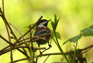
We were immediately greeted by bird songs, with both CHESTNUT-BACKED CHICKADEES and WILSON'S WARBLERS calling back and forth across the trail.
CHESTNUT-BACKED CHICKADEE


On the tree-lined path, dappled sun shone through the trees, with luscious foliage wearing the green-gold colors of spring.  The path is well-maintained, and an easy walk for two, hand-in-hand.


Between the path and creek, flowers bloomed in profusion, while ferns and grassy moss draped rocks and limbs over the water.   


As we neared the falls, we caught a glimpse of the upper cascade through the trees - a truly stunning sight and sound.


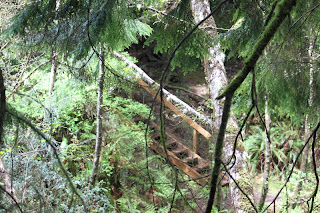
We reached an area where the original trail had fallen away.  A detour with some stairs bypassed the fall-in and returned us to the wider path.


On the other side, we were greeted by the sight and sound of the falls - all three cascades totalling over 300 feet.  Breathtaking.  It was hard to get it all into one photo.
Munson Creek Falls


A signed warned us not to go further on the path.  We have read that there is a more difficult upper trail, but did not see any indication of it. 


Looking around, we were again amazed by the long moss covering almost everything.  We found a STELLER'S JAY busily gathering some of it.


Walking back, we heard the call of birds all along the trail but saw very few.  The burbling creek is visible all the way.  Several more people were walking up the trail as we returned to our car.  


Munson Creek Falls State Park is worth seeing - if you are in the area you don't want to miss it!  The park has no facilities and no fee.  The drive is more difficult than the walk, which is well-maintained and wide start to finish, with just the one side trip up and down a few stairs.  Plenty of parking, but I wouldn't risk a large RV on those narrow roads.

Sunday, May 1, 2011

Spring Lake Open Space

I don't know how to begin to describe Spring Lake Open Space.  The original 15 acres were acquired by Lincoln City in 1996, with an additional 9.7 acres added in 2000.  
Friends of Wildwoods and Trails created at least some of the trails than wend through the property.  There is a rough one mile trail that loops around the lake, and others that venture up into an old clear cut.
Spring Lake
Lake Trail

The trail is muddy and uneven, not an easy walk, but well worth it.  It follows the lake edge closely most of the way, where the silty lake bottom is clearly visible through the water. 

Board bridge


At the north end of the lake, a wooden "bridge" provides narrow access to the other side.  Skunk cabbage and other wetland plants fill the marshy area.

Looking south from the board bridge
Stairs leading to west side path


On the west side of the lake, a fallen tree over the water provides a base for a number of small "trees" branching out from it. Very cool looking!


Looking east across the lake

The trees and bushes were full of songbirds - on our two visits (Friday and Saturday), we saw dozens of TOWNSEND'S WARBLERS, a couple of BLACK-THROATED GRAY WARBLERS (another first for us), as well as WILSON'S, YELLOW-RUMPED and ORANGE-CROWNED WARBLERS. 
Yellow-Rumped Warbler

Orange-Crowned Warbler
Townsend's Warbler

Black-Throated Gray Warbler (another 1st!)
Wilson's Warbler


Mallard


On the water, the only birds we saw were two drake MALLARDS (I assume the females were on well-hidden nests), as well as two female HOODED MERGANSERS.


Hooded Mergansers


We started our walks from the trail-head off of West Devil's Lake Rd (just west of Regatta Park), where the inviting path opens into dense forest. In the woods we were delighted by a BROWN CREEPER.


Following the wider trail upwards takes you to a large, older clear-cut area - we didn't follow these trails, but plan to return! 

Forget-me-nots

On the West side of the lake, we followed a trail heading almost due west, and discovered a wide, concrete path and a good-sized parking area off of Port Avenue - apparently part of the newer portion of the open space. 


Up here we again saw dozens of warblers, ANNA'S and RUFOUS HUMMINGBIRDS, and we counted at least four PACIFIC WRENS noisily calling. 

Pacific Wren

Heading back toward the lake from the concrete path (sign says "Port Lake Trail"), one of the PACIFIC WRENS was perched on a rotting stump, quite near us - apparently we had wandered too near his territory, and he was boldly telling us to scram.  I took a dozen pictures before we heeded his advice!


GETTING TO THE SPRING LAKE OPEN SPACE:

There are at least two ways to access the Spring Lake Open Space.  When we visited, we parked on a pull-out area on West Devils Lake Road, next to the lake.  Next time we'll probably park in the gravel parking area (now that we know it's there), and walk down to the lake from above.  From 101, turn east on NE 14th and follow it to Port, and turn left.  Parking lot is clearly visible on the right

If you start from the parking area and need an easy walk, you'll have to stay on the concrete path, where you will enjoy good birds and beautiful views, but you will miss seeing the lake.  If you venture onto the other paths, don't be fooled by the apparent wide welcome -- they are narrow and winding most of the time, rising and falling with the rough terrain, and muddy when damp -- probably would call these "moderately difficult".


If you want to see the lake but not take a hike, continue on 14th to West Devil's Lake Road and park in the turnout by the lake.  On the west side of the lake is a small path that takes you a short distance to a wooden bench, where you can sit and watch the lake and the birds without moving!